


BIM railway design Solution
Ferrovia is a professional, BIM ready solution for railway design and rail track analysis compliant with country-specific guidelines. Using its flexible, dynamic data model, it supports BIM workflows and processes, and IFC standardized data format.

Integrated railway design and maintenance
Ferrovia provides tools for alignment and profile design, detailed cross section design and editing, applied cant, turnouts and rail connections. Alignment and profile regression analysis tools provide users with options for comprehensive rail track realignment and tamping machine guidance capabilities.

Intuitive user interface
Carefully designed UI and workflows are consistent with the railway design engineering practice. This makes Ferrovia fast-to-learn and easy-to-use.
Our Customers’ Journey


Features
 CGS Labs solutions provide extensive BIM data support not limited to CAD platforms in use. 3D roadway, railway or river channel models are generated as detailed 3D solid objects with extended BIM metadata attached to objects, or as multiple surfaces for use with computer guided machines etc.
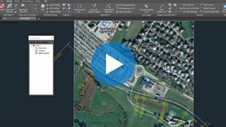
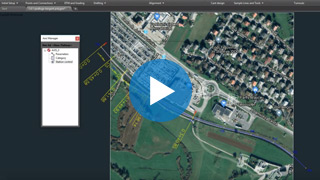
Ferrovia offers capable Property Manager for adding and changing 3D solids property data, which enables COBie (Construction Operations Building Information Exchange) compatibility.
Ferrovia 3D models and attribute data can be exported to IFC files. IFC export format is regularly updated according to buildingSMART International specifications.
Clash detection tool enables designer to search for possible collisions among selected 3D solid objects within the drawing itself thus saving the time to export models and create clash analysis in third party applications outside CAD environment.


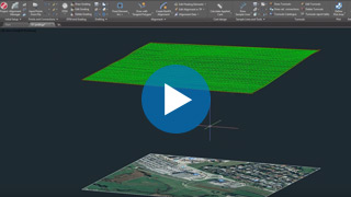
Digital Terrain Modeling
The Surface creation tool is included in CGS Labs software to produce a detailed Digital Terrain Model (DTM) based on various surveys or other input data: total station data files, points, break lines, blocks, etc. This offers the possibility to use Ferrovia on plain AutoCAD or BricsCAD. Plateia supports also surfaces from Civil 3D and BricsCAD (V20 or newer).

Grading
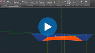
Creation of complex slopes with multiple conditions in cut or fill gives users the capability to cover various design scenarios and geometry requirements for all kind of road projects, from simple forest road design to complex intersection geometry design. Furthermore, creating ponds, parking areas, platforms, road, rail tracks, river channels, and other features is easier and faster with CGS Labs grading functionality.
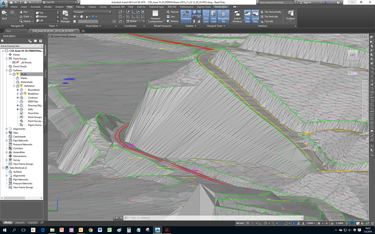
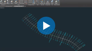
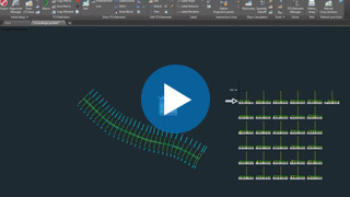
Railway Geometry Design Tools
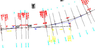
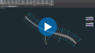
Ferrovia provides a wide set of advanced alignment, profile geometry design, and editing tools. They include P(V)I design, floating and fixed elements design, parallel alignment design, and alignment design created from the existing polyline, or ultimately creating a best-fit alignment based on existing rail track survey data. Various alignment labeling, reports, and data export options provide the flexibility needed to cover a wide range of user requirements.
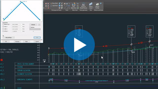
Transition Curves
Ferrovia supports a number of linear and nonlinear transition curves: Clothoid and a range of cubic parabolas, including; cubic parabola, modified cubic parabola, Czech parabola and Romanian parabola Imbonatatita. Supported nonlinear parabolas include sinusoidal, Cosines, Bloss and S–curve parabola. Transition curves apply uniformly to horizontal transition curves and to cant gradients areas.
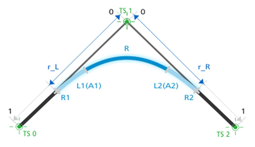
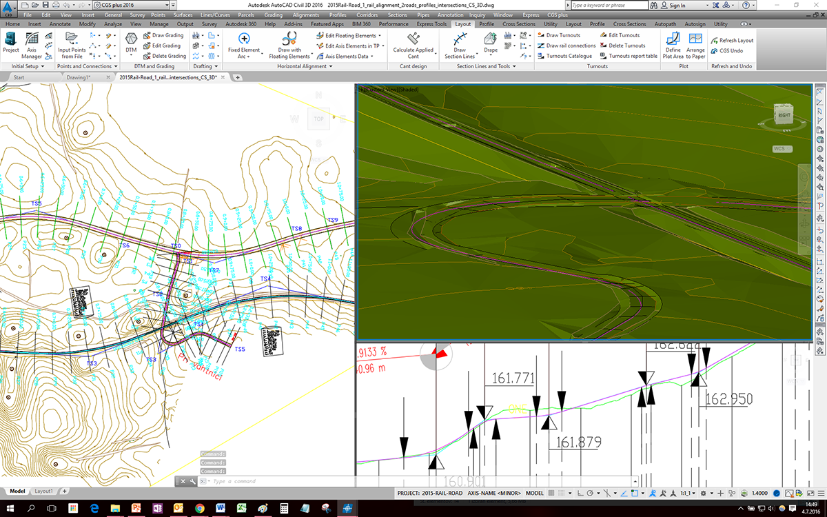
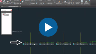
Turnouts
In turnout design you can take advantage of automatic turnout insertion, turnout parameter editing, and automatic turnout repositioning when alignment geometry changes apply. Included are various turnout types: straight-line turnouts (non-transformable), curve turnouts, symmetrical, and turnout crossings. Alongside predefined turnout geometry, a turnout catalogue provides users with the ability to edit or add custom geometry turnouts. Turnout reports provide the user with the tools to list turnout parameters and values in turnout tables, either in drawing or in external table files.


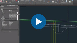
Rail Connections
Create rail connections interactively between parallel or non-parallel rail tracks in tangent or in curve with the geometry preview option. Having the advantage of using the same or different turnout types for rail connection gives users a wide range of geometry options to fit rail connections within constraint areas and limited design possibilities. Detailed design and editing of vertical connections in profile view add value to the comprehensive yet comfortable use of Ferrovia rail connection tools.


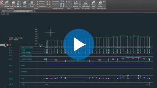
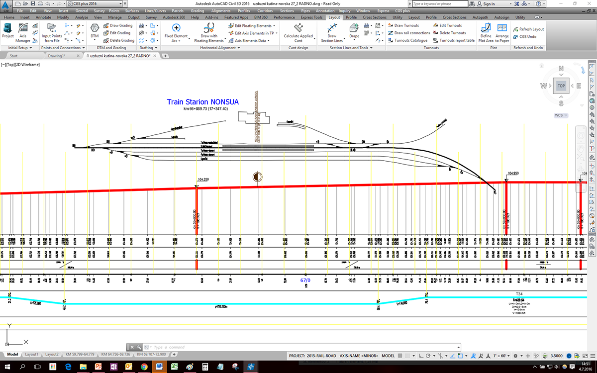
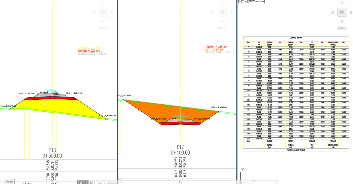
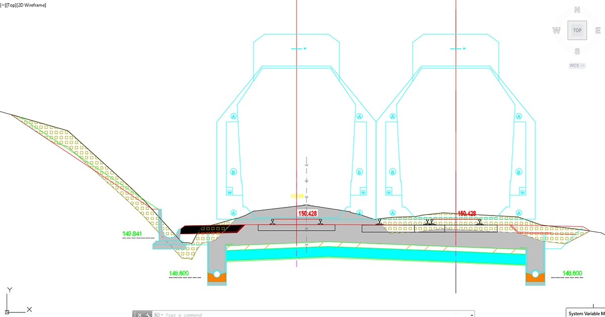
Detailed Cross Section Design and Editing
Ferrovia makes it possible to design and edit rail track cross sections in a detailed way with almost no geometry limitations to the final project design. Adding multiple rail tracks to a single cross section gives users control over the geometry between various rail tracks, rail tracks and roads or other infrastructure objects your project requires, and lets you define these areas with great accuracy and detail.

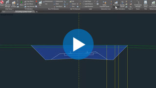


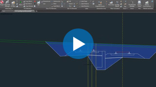

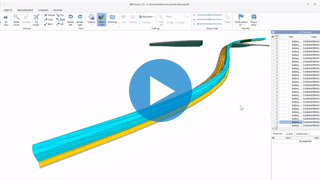
3D Surface and 3D Solid Model
Rail track 3D models can be created as a 3D surface or 3D solid model. 3D rail track surface models can be generated automatically from 3D rail-track cross-section geometry and terrain model, or it can be built with the grading function. The 3D solid model is created based on cross-section areas, where materials and volumes can be defined as extended data. With 3D solid tunnels, bridges and similar objects can be represented as well. Solid objects can be aligned with arcs and transition curves. All solid models, including extended data, can be imported into Autodesk Infraworks, Navisworks and then used in various BIM workflows.
Quantity take-off (QTO)
Ferrovia calculates material quantity take-off and features a QTO data export tool with custom defined Pay Item (Bill of Materials) options. It gives users the possibility to link material defined in the drawing with a material database in cost estimate software, thus supporting digital data transfer and fast cost recalculation when project changes arise.

Mass Haul Diagram
Mass haul diagram presents a graphical view of the material moved in the proposed design site. Mass haul diagrams help designers and contractors understand where gross material movements occur and compare the economies of alternative designs.
Road design tools
Road design tools are included in the Ferrovia Ultimate 4D software suite to provide users the tools they need to design roadways and rail tracks within the same project: Road–railway intersections for example, underpasses/overpasses, rail track construction access roads, side by side road/railway design, urban roads with tram lines, and more.
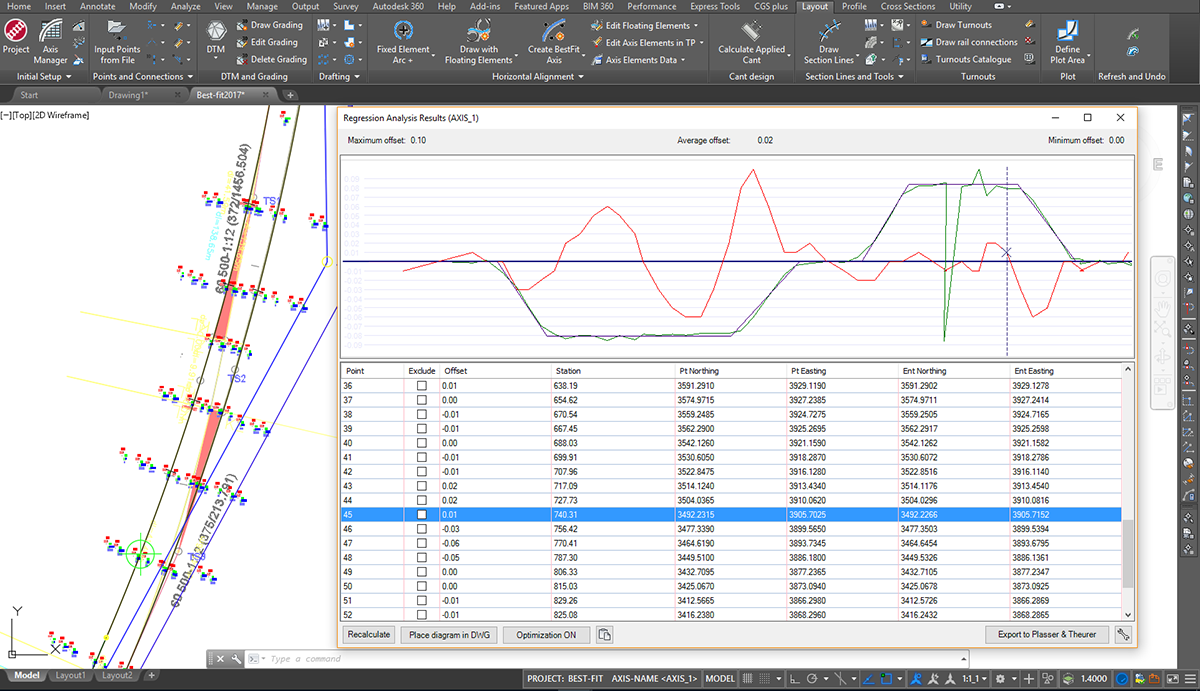
Horizontal and Vertical Regression Analysis
Ferrovia provides advanced and comprehensive technology for alignment and profile regression analysis and geometry optimizations options. Based on various input survey data and multiple editable parameters, alignments with appropriate transition curves are generated automatically, giving users the possibility to create realignment projects of any scale. Single regression elements are supported as well.
Options for converting surveyed rails to centerline review and edit regression points with point exclusion or inclusion in regression analysis lead to significant improvements in alignment or profile best-fit geometry. Multiple diagram options give users detailed information on curvature, transition areas, applied cant, and slew. All regression data is dynamically updated when changes occur.
Side-Track Objects Offset Analysis and Insurance Data Calculation
The side-track objects offset analysis tool give designers the tools to inspect any objects position alongside any alignment investigated in order to get offset data from side track masts, platform edges, retaining walls, tunnel contour, side track or road edges, etc.
For rail track realignment purposes insurance values can be calculated between fixed side objects (like overhead power line masts for example) and surveyed rail track position data in order to get absolute track layout data.
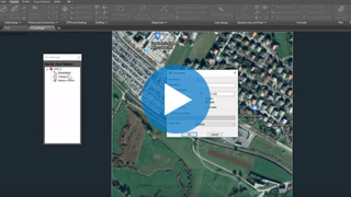
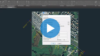
Google Maps & Google Street View
Google Maps Import makes it easy to import raster images and elevation data of a selected location from Google Maps into a DWG drawing in the selected coordinate system. Google Street View functionality is also available to allow the user to view the selected area interactively within the CAD environment.

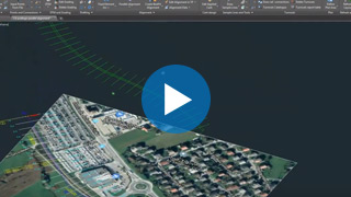
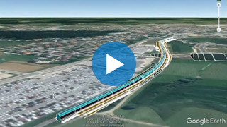
Google Earth Export
The Ferrovia BIM (3D solid) road infrastructure model can be quickly visualized directly into Google Earth. This allows us to present the project in an environment that enables the user to have exceptional visual performances.
Open Street Maps
Ferrovia provides geographic information for existing roads, railways and buildings for the planning area under consideration. Open Street Maps data is not locally restricted and can be used by the user for any area in the world where he plans projects.
Supported languages
- English
- Austrian German
- Czech
- German
- Hungarian
- Polish
- Serbian
- Slovenian
Supported CAD platforms
- Autodesk® AutoCAD® 2018 - 2025 (except AutoCAD LT)
- Autodesk® Civil 3D® 2018 - 2025
- BricsCAD® Pro, BIM and Ultimate V22 – V25
* Only 64-bit versions are supported
Select the version according to your needs
Available as a standalone or network license
- Survey data import
- Digital terrain modeling tool (CGS Labs DTM)
- 3D Grading
- Support for Civil 3D in BricsCAD surface
- Alignment design
- Profile design
- Cross sections design
- Turnouts design
- Linear and nonlinear transition curves
- 3D Railway modeling
- Points, lines and 3D solids projection to Profile View & Cross Sections Views
- Labeling and dimensioning tools
- Quantity Take-off & Mass Haul diagrams
- Interface for Civil 3D objects <-> Ferrovia
- Regression alignment and profile design (Best-Fit)
- Regression alignment and profile analysis and editing
- Rail Connections design
- Side-Track Objects Offset Analysis and Insurance Data Calculation
- Support for Plasser&Theurer tamping machinery
- Support for 3D solid objects
- Import of Google Maps geospatial data in CAD drawing
- Road design tools
- BIM object property tools (manager/editor/filter)
- 3D/BIM object clash analysis within AutoCAD, Civil 3D, and BricsCAD
- Import/Export LandXML data
- Import/Export 3D/BIM model to IFC 4.2 data format
- Export 3D railway model to Google Earth


