


»PLATEIA Traffic Collection« is a suite of productivity-oriented BIM-ready programs for Site design, Traffic signalization design & planning, and Vehicle swept path analysis. As an add-on to Civil 3D, AutoCAD or BricsCAD, it helps Road designers and Traffic engineers to significantly shorten the time needed to finish their projects.
Watch the webinar | Meet PLATEIA Traffic Collection
Features
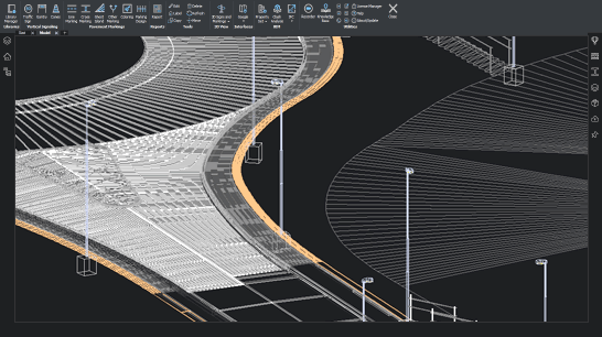
SITE DESIGN includes quick site modeling features, earthwork calculation, utility design, and productivity tools to speed up project delivery. It is ideal for fast conceptual projects, solution testing projects, detailed design, and earthwork projects including volume calculation, grading, and more. Serving data for machine control guidance, blueprints project delivery, survey data, and for great visualizations.

Surface
The terrain design is the main benefit of the new collection. Surface can be created based on the survey data or simply imported from Google Maps. The biggest advantage of this surface tool is that it creates ultralight surface models in an instant.
Google Maps & Google Street View
Google Maps Import makes it easy to import raster images and elevation data of a selected location from Google Maps into a DWG drawing in the selected coordinate system. Google Street View functionality is also available to allow the user to view the selected area interactively within the CAD environment.

Google Earth Export
Plateia BIM (3D solid) road infrastructure model can be quickly visualized directly into Google Earth. This allows us to present the project in an environment that enables the user to have exceptional visual performances.

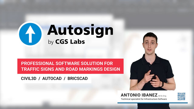
AUTOSIGN is a professional software solution for planning traffic signal design in CAD environments. It generates detailed layouts and reports. AUTOSIGN includes extensive collections of country-specific traffic sign libraries and road markings.
PLATEIA Traffic Collection offers the most capable software option, AUTOSIGN Ultimate.
[read more about Autosign]

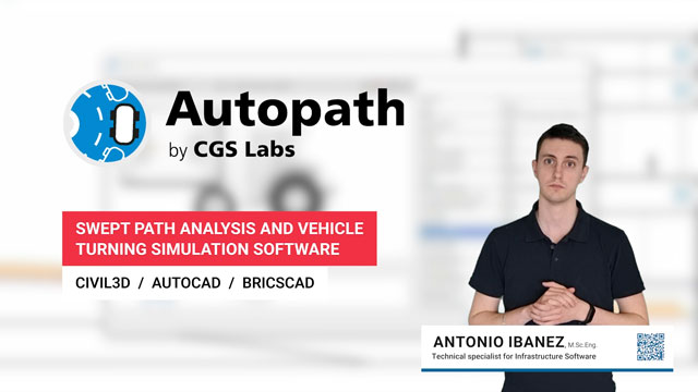
AUTOPATH is a professional software for swept path analysis and vehicle turning simulations. With it, you can easily and quickly simulate vehicle manoeuvres and check the transportability of all types of road design projects: on roads, intersections, roundabouts, hairpin turns, underpasses, overpasses, etc.
PLATEIA Traffic Collection offers the most capable software option, AUTOPATH Ultimate.
[read more about Autopath]


Supported languages
- Austrian German
- Croatian
- Czech
- English (International)
- English (USA-AASHTO)
- German
- Hungarian
- Polish
- Serbian
- Slovenian
Supported CAD platforms
- Autodesk® AutoCAD® 2018 - 2027 (except AutoCAD LT)
- Autodesk® Civil 3D® 2018 - 2027
- BricsCAD® Pro, BIM and Ultimate V22 – V26
* Only 64-bit versions are supported
Select the version according to your needs
Available as a standalone or network license
- Survey data import
- Digital terrain modeling tool (CGS Labs DTM)
- 3D Grading
- Support for Civil 3D and BricsCAD surface
- Alignment design
- Profile design
- Cross-sections design
- Road super elevations
- 3D Road modeling
- Points, lines and 3D solids projection to Profile View & Cross Sections Views
- Labeling and dimensioning tools
- Visibility analysis & Stop sight distance
- Quantity Take-off & Mass Haul diagrams
- Intersections design 2D/3D
- Roundabout design
- Intersections islands design
- Curb return fillets
- Interface for Civil 3D objects <-> Plateia
- Regression alignment and profile design (Best-Fit)
- Regression alignment and profile analysis and editing
- Side road objects distance calculation (Off-Set calculation)
- Import of Google Maps geospatial data in CAD drawing
- 2D Traffic signs and road markings design (Autosign Professional)
- 3D/BIM Traffic signs and road markings design & visualization (Autosign Ultimate)
- Vehicle swept path analysis and turning simulation (Autopath Professional)
- Support for 3D Solid objects
- BIM object property tools (manager/editor/filter)
- 3D/BIM object clash analysis within AutoCAD, Civil 3D, and BricsCAD
- Import/Export LandXML data
- Import/Export 3D/BIM model to IFC 4.2 data format
- Export 3D road model to Google Earth


References
Building the future together


