CGS Labs Blog
18.3.2024
What Is BIM?
Construction is one of the fields that is constantly evolving and changing. One of the most significant developments in…
0 Comments3 Minutes
12.2.2024
Do You Know the Difference Between Road Reconstruction and Rehabilitation?
Road maintenance and development are crucial aspects of infrastructure management, ensuring safe and efficient…
0 Comments5 Minutes
22.1.2024
Revolution on Tracks: The Continuous Evolution of Railway Vehicles
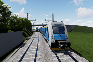
Railways have played a pivotal role in shaping human history, revolutionizing transportation and connectivity. The…
0 Comments4 Minutes
12.1.2024
High Capacity Vehicles: Environmental Problem or Solution?
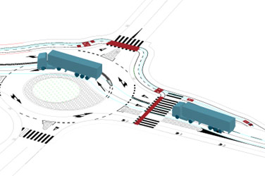
In the ever-evolving landscape of transportation, High Capacity Vehicles (HCVs) emerge as formidable contenders for the…
0 Comments6 Minutes
14.12.2023
Innovative Approaches to Designing Flood Protection Measures: Bright Side of Extraordinary Floods in Slovenia in 2023
In early August 2023, Slovenia was hit by a period of heavy rainfall with recurring storms, strong downpours, and…
0 Comments13 Minutes
4.12.2023
Game-Changing Innovations:
Autopath 2024.1
We are thrilled to announce the arrival of Autopath 2024.1, a landmark release that we believe will revolutionize your…
0 Comments6 Minutes
15.9.2023
New 3D BIM modelling methods for road and rail infrastructure
Matjaž Šajn, M. Sc. Civil Eng., CEO, Leon Leban, Product Manager, Klemen Ozimek, Bs. Civil. Environ., Petra Tihole,…
0 Comments2 Minutes
30.8.2023
The Historical Evolution of Road Markings
For centuries, roads have played an exceedingly important role in the development of human civilization, as they have…
0 Comments5 Minutes
25.7.2023
IPSA | How CGS Labs software helped us design a rapid exit taxiway for Sarajevo International Airport
CGS Labs software is a trusted solution for many companies that want to enhance their project management and…
0 Comments7 Minutes
13.6.2023
Projection lines labeling options in the profile view band
For several years now, CGS Labs Civil Solutions (Plateia, Ferrovia, Aquaterra) has empowered users with the capability…
0 Comments2 Minutes
30.5.2023
AUTOPATH 2024 features a new package – Intralogistics
Looking to take your logistics and warehouse management game to the next level? You know how crucial it is to have…
0 Comments4 Minutes
21.4.2023
MT Projekt | The construction of a “Park & Ride” parking lot
Michał Gal is a talented and highly promising civil engineer from MT Projekt, who shared with us an innovative parking…
0 Comments8 Minutes
20.3.2023
Three clicks are all you need: say goodbye to manually connecting points to a polyline
The Polyline from Points tool is a highly efficient software tool that enables the quick creation of specialized…
0 Comments2 Minutes
9.3.2023
The Easiest Volume Calculation Guide You’ll Ever Need!
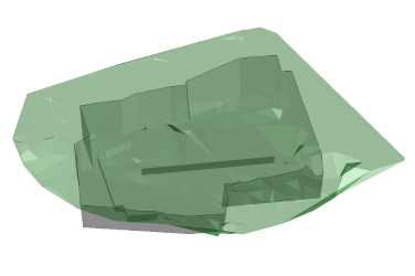
The Surface Volume Tool provides earthwork calculation values based on reference surfaces. This volume calculation is…
0 Comments3 Minutes
17.1.2023
AUTOPATH 2023.1 introduces Rear Steering Vehicles
The new version of AUTOPATH 2023.1 brings some practical functionalities and improvements. It supports rear steering…
0 Comments1 Minutes
19.12.2022
GRANOVA | First newly constructed railway line in Croatia in 52 years
Project name: New railway line Gradec – Sveti Ivan Žabno Location: Croatia Design team: Granova, a specialised project…
0 Comments9 Minutes
19.12.2022
GRANOVA | Analysis of Podsused – Tvornica – Samobor – Perivoj railway construction options
Based on the Transport Development Strategy, the Republic of Croatia has defined general objectives through which it…
0 Comments9 Minutes
25.11.2022
SIMM Engineering’s PLATEIA Experience
Foto: SIMM Engineering" My first experience with PLATEIA software goes back to the 90s. I worked on a project for a…
0 Comments4 Minutes
6.10.2022
VIAING’s experience using PLATEIA software on road infrastructure projects
Company VIAING was founded in 2012 by Riste Ristovski, a civil engineer, with more than 30 years of experience in…
0 Comments5 Minutes
14.9.2022
How to change the direction of the station?
A station control tool enables one or more station value definitions along the alignment. This tool is integrated…
0 Comments2 Minutes
27.7.2022
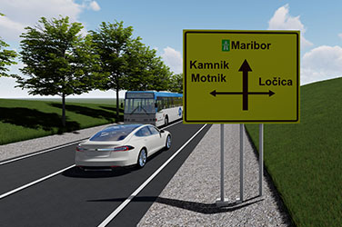
Traffic signs and directional signs with editable text
Did you know that AUTOSIGN software allows you to easily edit text and attributes of traffic or directional signs and…
0 Comments2 Minutes
15.7.2022
External Reference Surfaces
Alignments, points, polylines and other entities supported by CGS Labs solutions can be now projected/draped to…
0 Comments10 Minutes
8.7.2022
A new generation of Autopath software
In the latest release, our development team has proven once again, that they know how to think out of the box and they…
0 Comments5 Minutes
12.5.2022
Was the choice of the track gauge value a coincidence?
Track gauge is the minimum distance between the inner edges of the rail heads and is measured at a distance of 0 to 14…
0 Comments4 Minutes
21.4.2022
TCS Elements Manager
»TCS elements manager« is a tool used for zooming to a specific cross-section or elements within the cross-section…
0 Comments3 Minutes
13.4.2022
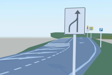
Unusual road traffic signalling around the world
An interactive method for creating swept path analysis - Easy Drive The…
0 Comments4 Minutes
31.3.2022
Points report
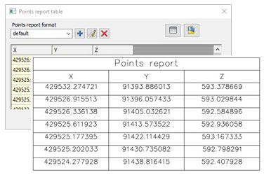
Plateia, Ferrovia and Aquaterra offers several functionalities to export points into different file formats. Points…
0 Comments3 Minutes
23.3.2022
BIM pilot project Godovič
Can you imagine that more than a thousand experts are involved in one project and they are drawing the road on paper?…
0 Comments5 Minutes
1.3.2022
PNZ | Construction documentation for road Hrastnik – Zidani Most and road deviation Rimske Toplice – Zidani Most – Radeče
Project name: Construction documentation G2-108 Hrastnik – Zidani Most and road deviation G1-5 Rimske Toplice…
0 Comments5 Minutes
23.2.2022
VILNIAUS PLANAS | Reconstruction of streets and bicycle paths in Vilnius, the capital of Lithuania
Vilniaus planas has been working hand-in-hand with Vilnius City Municipality for over 20 years. We are currently…
0 Comments3 Minutes
17.2.2022
CIP | State border railway line section Novi Sad – Subotica
Institute of Transportation CIP from Belgrade, Serbia used CGS Labs software FERROVIA to design a state border railway…
0 Comments2 Minutes
3.2.2022
Discover 2022.2
We are delighted to welcome you back to Autosign blog. There are exciting news coming up and we would like to share it…
0 Comments5 Minutes
31.1.2022
Welcome Autopath 2022.2
Hello, dear Autopath users. We have started the new year by developing new functionalities that are now included in the…
0 Comments2 Minutes
17.1.2022
Automated creation and editing of cross-sections
Macro feature automates the creation and editing of cross-sections, which significantly speeds up the designing…
0 Comments4 Minutes
10.1.2022
BIM is the key to successful railway projects
Railway infrastructure is a complex and multi-disciplinary engineering system that must be planned very carefully and…
0 Comments4 Minutes
15.12.2021
All-in-one
Warm welcome to this post, Today’s topic is one of the most interesting aspects that must be treated when targeting a…
0 Comments5 Minutes
1.12.2021
New version 2022.1, brings new enhancements
We are pleased to announce the launch of our new software version. Autopath 2022.1 incorporates a variety of…
0 Comments2 Minutes
30.11.2021
AUTOSIGN 2022.1 – Straight ahead
ATTENTION: This post includes extremely valuable news. WHAT We are delighted to announce the release of the newest…
0 Comments5 Minutes
25.7.2021
Strenk Management Consulting Uses Autopath for Expert Testimony
A recent case highlights how SMC relies on CGS Labs Autopath. SMC was hired to provide expert witness services for a…
0 Comments5 Minutes
25.7.2021
KUKA delivers industrial flexibility with Autopath
Designing and implementing paths for automated vehicles is a challenge. They must be able to navigate the work area (in…
0 Comments8 Minutes
23.7.2021
IFC – I feel curious
Kind welcome to this new post! No, we neither misunderstood the meaning of “IFC” nor decided to change its meaning.…
0 Comments3 Minutes
23.7.2021
Areas of application – Autosign
Warm welcome to this new post! Probably none of you is entirely aware of all the ways on which Autosign can be useful…
0 Comments2 Minutes
23.7.2021
Follow the signs – Autosign 2022 is out!
We are thrilled to welcome you to Autosign blog! From CGS Labs we have established this space to share information,…
0 Comments4 Minutes
24.6.2021
Autopath 2022 is available now!
We are introducing a new software version. Autopath 2022 includes exciting new enhancements and functionality that…
0 Comments2 Minutes
2.12.2020
Hello, Autopath 2021.1!
I am very pleased to announce that we have released Autopath 2021.1! This version brings some new features that help…
0 Comments2 Minutes
20.10.2020
Horizontal swept path Analysis
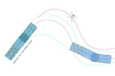
With Autopath, swept path analysis can be made simply by clicking on a polyline, 3D polyline, or alignment defining a…
0 Comments1 Minutes
22.9.2020
Path to win Tour de France
No words are needed! Slovenia celebrates a double victory at Toure de France! Autopath is Slovenian product…
0 Comments1 Minute
8.9.2020
TRAFFIC CALMING – narrowing the streets
Traffic calming is a system of design and management strategies that aim to balance traffic on streets with other…
0 Comments1 Minutes
24.8.2020
An interactive method for creating swept path analysis
With Autopath various methods are available for creating horizontal and vertical swept path analysis. Interactive,…
0 Comments2 Minutes
5.8.2020
Vehicle libraries
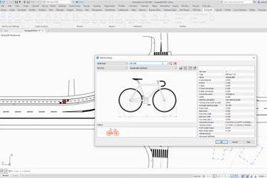
To facilitate the swept path analysis process, Autopath already includes a list of predefined vehicle design libraries…
0 Comments4 Minutes
20.7.2020
Why Swept Path Analysis is useful – II
Have you ever wondered how wind farms are created? No, they do not grow on site. Every component of the windmill must…
0 Comments3 Minutes
6.7.2020
Why Swept Path Analysis is useful – I
Design software applications for a site or urban development sometimes need to prove that the plan layout can…
0 Comments2 Minutes
15.6.2020
Hello, Autopath 2021!
I am happy to inform you that we released Autopath 2021! The release brings some new functionality and support for the…
0 Comments1 Minutes
29.5.2020
What is Swept Path Analysis
Swept Path Analysis is the calculation and analysis of the movement and path of different parts of a vehicle when that…
0 Comments3 Minutes
13.5.2020
Google Maps Import
Autopath provides unique raster imagery and Elevation data (Earth Surface data) insertion options and Street View…
0 Comments1 Minutes
25.7.2015
Alm River flood risk mapping
Ingenieurbüro Neukirchen, a reputable consulting company from Vienna, Austria, has used the AQUATERRA-MIKE connection…
0 Comments1 Minutes


